Category Archives: Recreation

Ft. Ord Mountain Bike Rides

On the first Saturday of each month, the Monterey Off Road Cycling Association (MORCA) holds organized mountain bike rides on Ft. Ord trails.  These rides are led by experienced MORCA members who have knowledge of the trails. To participate in a beginner ride, you should have done some riding on your mountain bike and be able to keep up with an easy pace for an hour or more.  If you are a more experienced mountain biker, you may be able to ride with others at an intermediate or advanced level.

Participation is free, but you need to turn in a signed waiver before the ride (see website).  You must bring a helmet, as well as your bike, and be ready to ride by 9 am.  It’s also recommended that you bring water, sunscreen and a snack with you on the ride.

The rides last two hours and may be followed by a tailgate for those who have brought food or beverage to share.  For more information, visit the First Saturday MORCA Ride webpage.  The MORCA website also provides information about other scheduled events, maps of local trails, and resources for mountain bikers.

Marina Library

Marina Library
190 Seaside Circle
Marina, CA 93933

One of my favorite places to spend a quiet afternoon is the Marina Library. Located next to Locke-Paddon Park, the Marina Library has a collection of fiction and non-fiction, comfortable chairs and tables for reading and study, a children’s room, and Internet-connected computers available for use by library card holders. There’s also a small outdoor playground area so children can have some physical activity before or after quiet time in the library. Since it’s part of a larger library system, you can search the online catalog and request any book or media item shown.

The Marina Branch Library, which is part of the Monterey County Free Libraries had the grand opening in its current facility on September 29, 2007.  Prior to that, the library had to make do with a storefront space in the Seacrest Plaza shopping center.  The current library owes its existence, in part, to a community organization known as The Friends of the Marina Library.

Marina Dunes Preserve

Photo Credit: Diane Kodama/USFWS

The Marina Dunes Preserve, which is part of the Monterey Peninsula Regional Park District, includes a beach to the north of the Marina State Beach and the dunes area between the beach and Dunes Drive. Formerly the site of a sand mine, this area is now protected and being restored to a native coastal dunes habitat. Access to the beach is provided by a short path which can be reached by taking Reservation Road (west from Highway 1) to  Dunes Drive, turning right and driving to the cul-de-sac at the end of the road. There is no parking lot, but street parking is permitted. The park is open from sunrise to sunset, with no overnight stays or camping permitted. Due to risk of wildfires, you may not smoke or use any kind of fire or incendiary device at this park.

Dogs and other pets on leash are permitted here, but you must stay out of the protected areas and clean up any leavings. Also, be aware that there may be snakes and other critters in the dunes vegetation, and the ocean has dangerous currents here just as at Marina State Beach. Keep pets and small children close and under control.

Walking through the Marina Dunes Preserve allows you to view a native coastal ecosystem, with opportunities for nature photography and the possibility of sighting  some of the 20+ different bird species that may found in this area.  As you walk along the path, you will see signage with information about the native plants and small animals. If you are lucky, you may see the rare  and tiny Smith’s blue butterfly, which is only found in the coastal dune habitat.

This is a look-but-don’t-take area with no hunting, fishing or collection of plant specimens permitted. However, there are sometimes scheduled events in which volunteers may help with the gathering of seeds from native plants and other habitat preservation activities.

Marina State Beach


Bring your jacket, leave your dog at home, and come to watch the mesmerizing waves at the Marina State Beach. Parking is free, though the lot is small, so you may have trouble finding a space at the more popular times, which tend to be around sunset on weekends and holidays. The parking lot is situated on a coastal dune, so you need to walk down a sandy slope to reach the water and then back up to return to your car.
Between the parking lot and the water, there are three weathered picnic tables situated in the sand. There are also restrooms near the parking lot.

You really don’t want to bring your dog to this beach, even if you’re the type to ignore the rules.  There’s a rip tide that can wash a dog — or a small child — out into deep and cold ocean waters. So caution your children and keep them close. Enjoy the surf, but stay on the sand unless you know what you’re doing.

If you come in the morning, you can sit in your car and sip hot coffee while watching and listening to the surf below. If you’re up for a walk or run along the ocean, there are miles of water-packed sand. You might see a fisherman or two surfcasting, and you might find some beach glass or pretty shells. Later in the day, you may see hang gliding or kite flying. This beach also has become a popular place for radio-controlled gliders. There’s almost always a steady breeze blowing in from the ocean here. This makes the Marina State Beach great for wind sports, and it’s also why you want to bring a jacket.

The dunes above the beach are home to a variety of native plants and animals, some of them rare or endangered. Just before the entrance to the parking lot, to the left you may be able to access a trail (recent conditions permitting) that lets you to enjoy great views while walking along the high dunes parallel to the beach. It’s about .6 miles round trip if you walk to the end of this trail and then return via the beach. The trail was originally designed to provide an easy walk along wooden boardwalks and sand ladders, but the winds and shifting sands make these difficult to maintain. The California Department of Parks and Recreation no longer lists this trail, so you may find that parts of it have been reclaimed by the wild dunes.

If you walk in the dunes, be aware that you are not allowed to damage, interfere with or remove any plants, animals, natural objects or cultural artifacts that you may encounter. Take away photos and memories.  Leave behind only footprints in the sand for the winds to sweep away.

Fort Ord National Monument

Created in 2012 on lands of a former military base, the Fort Ord National Monument has a fascinating history and offers unique recreational opportunities. The monument currently provides 86 miles of paved and unpaved trails that can be explored by hiking, bicycling, or horseback riding. These trails include a section of the route taken by Juan Bautista de Anza in 1774-1776 when he led a group of settlers from Sonora, Mexico to what is now San Francisco. Along this historic trail, you can learn about the basket weaving techniques of the Rumsen Ohlone people who were living in in the area long before European explorers and settlers first passed through. In another area, near Trail 49, you can see a portion of a pipeline that carried oil to Monterey from the Coalinga Oil Fields in Fresno County from 1904 until the Great Fire of Monterey in 1924.

In 1917, the U.S. Army purchased what had been agricultural lands  to create the Gigling (miliary) Reservation (aka Camp Gigling), which was used primarily for the training and exercise of horse calvary and field artillery units. This area was were left largely as dune and backcountry wildlands until the late 1930s.

In 1938-40, the Army acquired additional lands and consolidated the former Gigling Reservation (briefly designated as Camp Ord) with other nearby Army training camps, creating Fort Ord to accommodate the reactivated 7th Infantry Division and additional planned troops. At this time, horses were still considered important for military operations, and the first buildings constructed at Fort Ord by the civilian employees of the Works Progress Administration included 21 stables and workshops for blacksmiths and saddle makers. These were used first by the 76th Field Artillery Regiment and then by the 107th Cavalry and the 68th Quartermasters Corps Pack Troops. During WWII, 1400 horses and mules were stationed at Fort Ord, making it one of the last locations for U. S. Army horse-drawn artillery, mounted horse calvary and horse mechanized units.

On 5th Avenue near 9th Street  you may still be able to see a part of what was once the Fort Ord Station Veterinary Hospital, formerly used for the care of military horses and mules. (Although this site was listed on the National Register of Historic Places in 2014, that is no guarantee of its preservation.)  There’s also a short trail leading the grave of Comanche, the last ceremonial horse of Fort Ord. The trail is named after Sgt. Allan MacDonald who enlisted in the horse cavalry when he was 17 years old and continued to work with horses and mules in various capacities during his service in the U. S. Army until his retirement in 1965. Sgt. Allan MacDonald  acquired Comanche from a Bureau of Land Management wild mustang roundup and rode her in ceremonies at Fort Ord for 23 years.

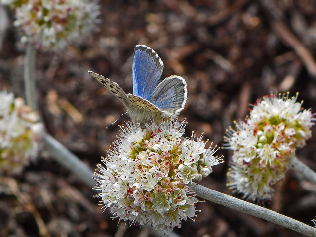
In addition to having historical and cultural significance, the  Fort Ord National Monument preserves some of  the last undeveloped natural wildlands on the Monterey Peninsula. These include 12 different habitat types, which include riparian forest, perennial grasslands and vernal pools.  In these native coastal habitats, now being restored and protected by the BLM with help from volunteers, there are 35 species of rare plants and animals along with many more common varieties.

You can get a feel for the scenery along the Fort Ord trails from the photos of Bob Wick (BLM). The National Monument is open from dawn to dusk. Stay on the trails, for your own safety as well as to protect a sensitive ecosystem, and do not collect natural materials. For further information, visit the BLM’s website for the Fort Ord National Monument.


Sources:

Bureau of Land Management, U.S. Department of the Interior (n.d.). Fort Ord National Monument Brochure. https://www.blm.gov/nlcs_web/sites/style/medialib/blm/ca/pdf/hollister/fortord.Par.31831.File.dat/FortOrd_NM_brochure_150_508.pdf

Davis, M. (2010, November). The Forgotten Warhorse History of Fort Ord. News from the Monterey County Historical Society. Online copy no longer available.

Howe, K. (2011, March 6). Fort Ord trail named after former Army horse soldier. San Jose Mercury News – Central Coast. Online copy no longer available.

Molnar, P (2013, November 9). Fort Ord Veterans Day event celebrates war horses. The Herald (website of the Monterey County Herald).  http://www.montereyherald.com/news/ci_24491695/fort-ord-veterans-day-event-celebrates-war-horses.